GIS-based building data for municipal heat planning and heat network planning
Building-level GIS data is the foundation of efficient municipal heat planning and the identification of suitable areas for heat networks (potential analyses). It enables a precise determination of heat demand and forms the data basis for the heat transition in cities and municipalities.
Why is building-level data central to municipal heat planning?
Building-level data is the basis for developing robust energy concepts. Precise building data is particularly important for the economic viability of heat networks, because heat networks can only be operated profitably where the heat line density is sufficiently high. Heat line density results from the sum of the heat demands of all connected buildings along a route relative to the network length. The more accurate the underlying building data, the better it is possible to estimate how many buildings can actually be connected, what heat demand can realistically be expected, and which route variants are economically viable. For planners, municipal utilities, and municipalities, the availability of reliable building data is therefore crucial.
Which building data is required for municipal heat planning?
In particular, structural, energy, and condition data is needed, from which both current and future heat demand can be derived.
Key attributes include:
- Building type (e.g., single-family home, multi-family home, non-residential buildings such as offices, schools, or commercial buildings).
- Year of construction / building age class, to derive energy standards (U-values).
- Usable floor area as a central basis for calculating space-heating demand.
- Number of storeys and building geometry to estimate building envelope area and compactness.
- Energy carrier / heating system type (e.g., gas, oil, district heating, electricity, biomass), to plan transformation pathways and conversion strategies (especially relevant for municipal heat planning).
What can building-level GIS datasets be used for?
Building-level GIS datasets are primarily used for municipal heat planning (identification of suitable areas for heat networks; heat-network suitability areas), the execution of potential analyses, the creation of feasibility studies, heat network planning in detailed/technical planning, the development of transformation plans for existing networks, and more generally for drafting neighborhood/district energy concepts.
In which formats is building data provided?
Typically, building-level GIS data is provided as GIS datasets (GIS: Geographic Information System). Typical GIS data formats are listed in the table below:
| Format | Advantages | Disadvantages |
|---|---|---|
| Shapefile (.shp) | Widely used and compatible with almost all GIS systems | Limited to 2 GB; consists of multiple files (.shp, .dbf, .shx, etc.) |
| GeoJSON | Lightweight and web-friendly; also human-readable/editable | inefficient for very large datasets |
| GeoPackage (.gpkg) | Stores multiple layers in one file | Sometimes lower compatibility with older systems |
| CSV with coordinates | Very simple and universal format; compatible with Excel; well suited for point data | No native geometry structure; requires post-processing in GIS |
Which software tools can be used to open and edit GIS data?
Different software solutions are available for editing and analyzing GIS data—from free open-source programs to professional enterprise solutions:
- QGIS: Free open-source software with a very wide range of features for visualization, analysis, and editing of geodata. Due to its license-free nature and flexibility, it is especially suitable for municipalities, planning offices, and engineering firms. However, it is comparatively complex to use and requires a corresponding learning effort.
- ArcGIS Pro: Commercial, professional GIS platform with comprehensive analysis capabilities and strong integration into enterprise environments. Often used by larger organizations, state authorities, and companies with high requirements for data management and automation.
- AutoCAD Map 3D: Combination of CAD and GIS functionality. Particularly suitable for technical planning processes, for example in infrastructure planning, surveying, or network planning.
How much does building-level data cost?
Costs depend on the level of processing. A distinction must be made between providing only raw building data and offering already processed and enriched datasets. In addition, data quality plays a role. Datasets that already contain fully modeled heat-demand data are more expensive than pure building data. Spatial resolution (e.g., building-level data versus data only at building-block level) also affects costs. Overall, the costs for building-level GIS datasets for municipal heat planning can range between €0.10 and €5 per building, depending on the factors mentioned. As a rule of thumb, €1 to €2 per building for a dataset of 1,000 buildings can be assumed. It is advisable to compare the scope of use (license model) more closely: in some cases, the data can only be used for certain use cases or time periods. Make sure the data may also be used for the intended applications (e.g., potential analysis, feasibility study, etc.) and not only for a very limited scope (such as municipal heat planning).
Collect data yourself or use external data sources?
Typically, building-level GIS data is used for the first planning steps (e.g., municipal heat planning, feasibility study). In later planning phases, this data is often supplemented or updated through own surveys (e.g., on-site inspections, surveys, etc.).
Which datasets are publicly and freely available (open-source)?
There is some free data, most notably the 3D building models of the federal states in Germany. These are usually available in CityGML format, but in addition to building geometry they often include only explicit building attributes such as building height and usage type as well as address information. In addition, data from census surveys (most recently 2022) can be used, which mainly includes information on the year of construction and the currently used heating type. However, the challenge is that these are only available for 100 x 100 m grid cells, which makes further data processing steps necessary. Another good source of building data is OpenStreetMap, which, however, usually contains only building geometry and address information.
For municipalities and planners, the biggest challenge is less the data acquisition itself, but rather the logical linking of the different datasets. The data is often available in different formats, may have slightly differing geometries, or contain different building attributes. Merging geometries, address information, raster data (e.g., census data), and in some cases pseudonymized data requires experience in working with databases and geo coordinate systems, as well as programming skills, for example with Python.
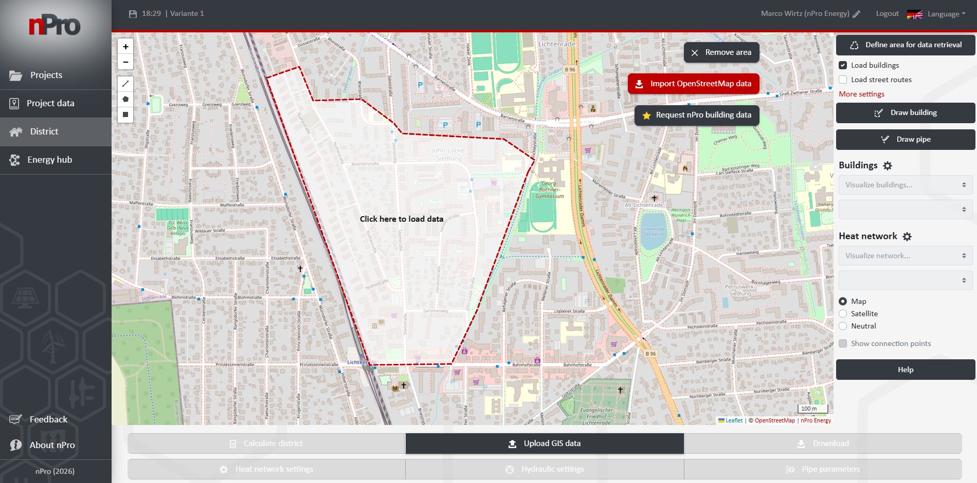
How can nPro help with data procurement?
To make using the nPro software as easy as possible, nPro offers a convenient way to obtain building-level GIS datasets. Detailed information can be found on the page Request GIS data via nPro. For an individual request, you can simply send us your project area by email (ideally with a screenshot or a short description of the relevant area). Even more efficient is a direct request via an nPro demo account within the software: simply mark your desired study area and send your request directly from the application. You can also specify whether commercial data providers should be considered as well.
 English
 Deutsch


